Abstract
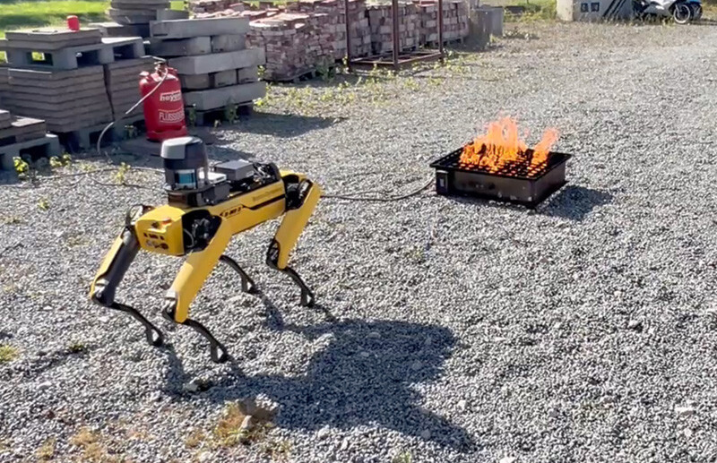
Safely moving through environments affected by fire is a critical capability for autonomous mobile robots deployed in disaster response. In this work, we present a novel approach for mobile robots to understand fire through building real-time thermal radiation fields. We register depth and thermal images to obtain a 3D point cloud annotated with temperature values. From these data, we identify fires and use the Stefan–Boltzmann law to approximate the thermal radiation in empty spaces. This enables the construction of a continuous thermal radiation field over the environment. We show that this representation can be used for robot navigation, where we embed thermal constraints into the cost map to compute collision-free and thermally safe paths. We validate our approach on a Boston Dynamics Spot robot in controlled experimental settings. Our experiments demonstrate the robot's ability to avoid hazardous regions while still reaching navigation goals. Our approach paves the way toward mobile robots that can be autonomously deployed in fire-affected environments, with potential applications in search-and-rescue, firefighting, and hazardous material response.
Video
Method Overview

We use stereo depth and thermal sensor data to capture a fire (a) and compute a thermally annotated point cloud (b). We take the highest-temperature points and project them into a 2D grid (c), then use the Stefan–Boltzmann law to estimate the heat decay of the fire (d). Finally, we integrate the resulting thermal occupancy map with a common spatial occupancy map for fire-aware robot navigation (e).
Contributions
- We register thermal and depth sensor images on a legged robot to produce 3D point clouds annotated with temperature measurements.
- We detect and localize a fire by clustering high-temperature 3D points.
- We construct a continuous free-space radiative heat-flux field using a Stefan–Boltzmann-based power estimate, and inject it directly into an A*-based planner for collision-free, thermally safe navigation.
Results
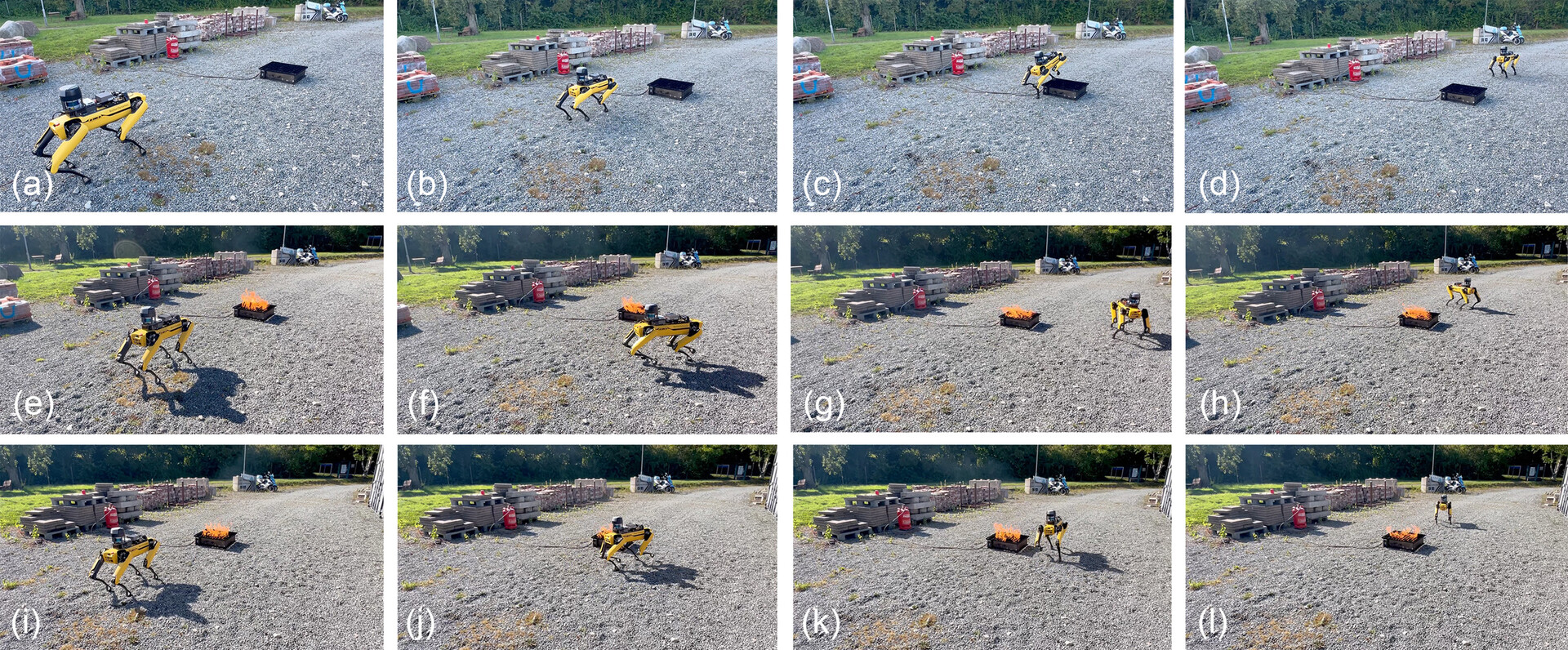
Fire-aware navigation: with no fire the robot walks over the training device (a–d); with a larger safety margin it routes further from the fire (e–h); with a smaller margin it takes a closer path (i–l).
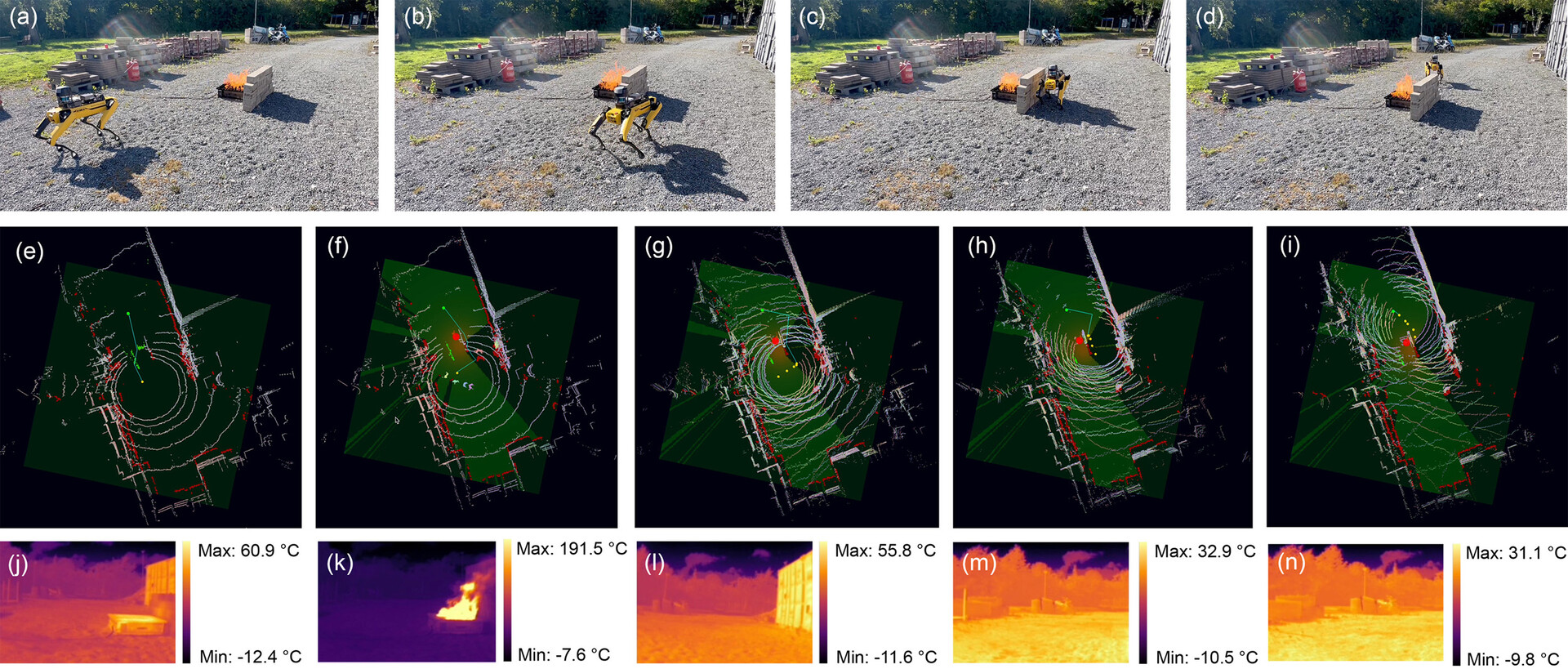
Thermal occlusion: when a wall blocks the fire source, the approach dynamically re-plans a path that also respects the hazardous space adjacent to the wall; thermal images show measured temperatures along the path.
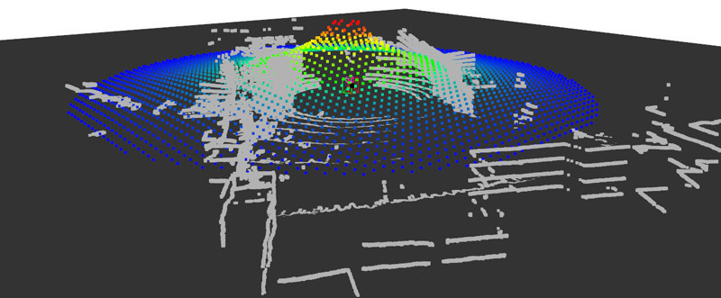
Thermal radiation profile of our model: radiation values from the thermal radiation field (colored points) overlaid on a LiDAR scan of the scene (grey points).
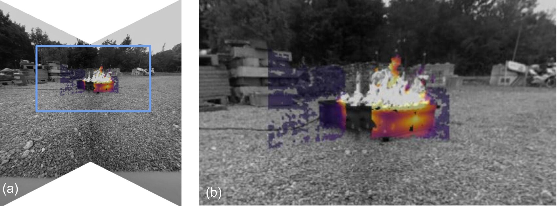
Depth–thermal registration: the Spot's RGB frames (shown in grayscale) with a color-coded thermal overlay, alongside a zoomed-in view showing the alignment detail.
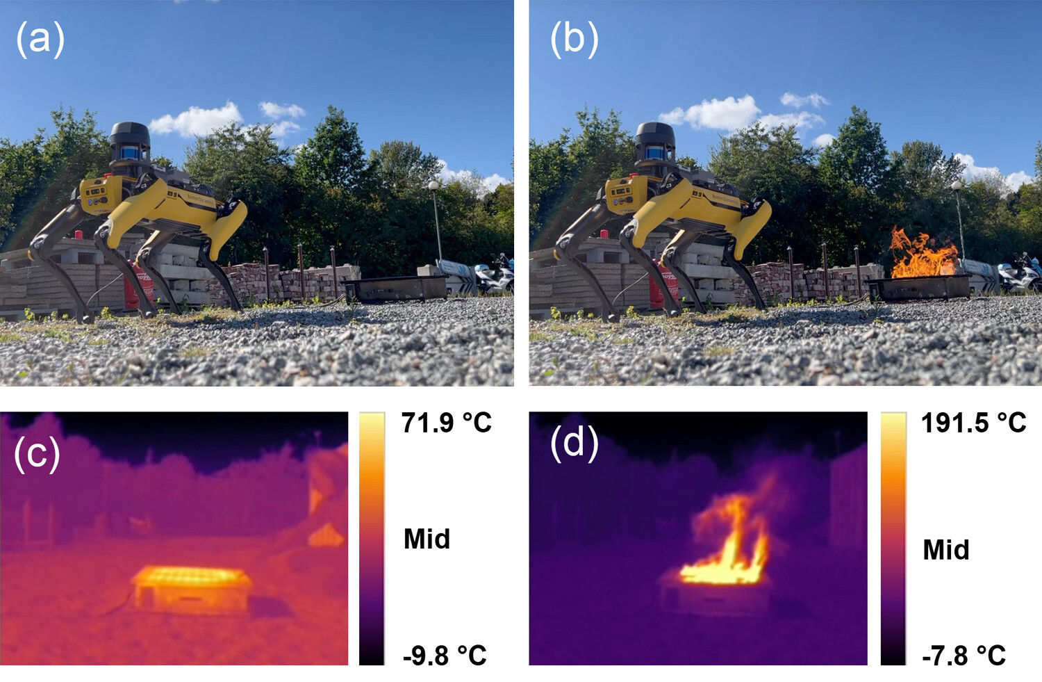
Experimental setup with the fire source off (a) and on (b), with the corresponding onboard thermal images (c, d) showing the temperatures measured by the robot's thermal camera.
BibTeX
@misc{wagner2026thermalradiation,
  title         = {Understanding Fire Through Thermal Radiation Fields for Mobile Robots},
  author        = {Wagner, Anton R. and Rao, Madhan B. and Xiao, Xuesu and Pirk, S{\"o}ren},
  year          = {2026},
  eprint        = {2602.19108},
  archivePrefix = {arXiv},
  primaryClass  = {cs.RO},
  url           = {https://arxiv.org/abs/2602.19108}
}